October 24, 2017 Voyage Recorder PC Software update
This minor update adds TWA (True Wind Angle) to the list of wind parameters supported (TWD, TWS, AWA, and AWS). All parameters are now available in GPX (tracks), CSV (spreadsheets) and logbook output files.
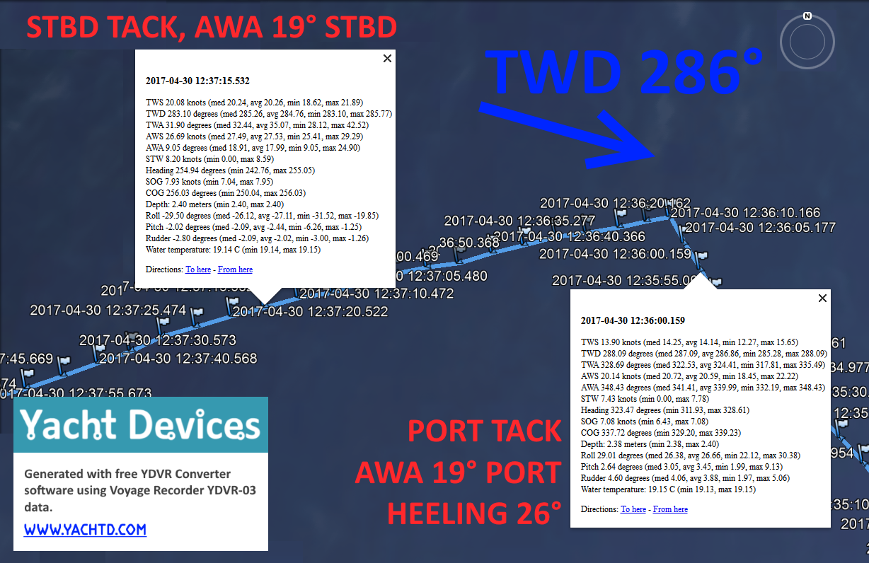
The screenshot above (click to enlarge) is taken from Google Earth with a track generated by the new v1.29 software version. As with AWA, TWA is wind relative to the vessel centerline (heading). On the port tack, we can see that the median value of the apparent wind angle was 341 degrees (or 19 degrees to port) and true wind angle was 322 degrees (or 38 degrees to port). On the starboard tack, apparent wind angle was 19 degrees (to starboard) and true wind angle was 32 degrees.
Along with roll (heeling) and pitch data, and with the rudder angle, this allows analyzing of sail settings and crew/boat balance. Despite the track above being recorded on a racing yacht, the same data are available on the most modern cruisers equipped with autopilot.
A new log book macro was also added, see Appendix B of the YDVR Converter manual for details.
Updated version is available on the Downloads page.
Next articles:
- Control of Raymarine autopilots was added to our gateways / October 6, 2017
- Using Navionics Boating App with NMEA 2000 Wi-Fi Gateway / September 22, 2017
- Update for Engine Gateway YDEG-04 and CAN Log Viewer / September 8, 2017
Previous articles:
- Update v1.07 for USB, Wi-Fi and NMEA 0183 gateways / October 30, 2017
- How to set up a pair of Wi-Fi Gateways as a NMEA 2000 wireless bridge / November 7, 2017
- CAN Log Viewer update 1.06 for Windows, Linux and Mac
OS X / November 8, 2017
See also: recent news, all news...